
Olympic National Forest

Pulling into my camp spot
As a trail guide for OnX Off-Road, I’ve had the chance to explore some incredible areas near me—and this past spring, I decided to spend some time around the Lake Cushman area. I mapped out a couple of trails, each offering unique views and experiences.
Trail 1 – Staircase Area:
The first trail led me to a few camping spots, one of which I instantly fell in love with. To get there, head up to the Lake Cushman area and follow the signs to “Staircase.” This takes you down a gravel road along the lake for a few miles. About half a mile before reaching Staircase, look for a road branching off to the left that crosses the lake—follow it over the bridge and up the road. You’ll pass a few cabins before reaching a trailhead for hiking.
At the trailhead, the road narrows and begins to climb. A few miles in, the road splits. On the OnX maps, both forks are clearly marked. Taking the left fork continues to climb and leads to a few small dispersed camping areas with plenty of parking for multiple vehicles. Personally, I preferred the right fork. The trail tightens as you progress, and about halfway in, there’s a quarter-mile side trail to the right that opens up to a stunning valley view. I set up my hammock from the Jeep to a tree and just relaxed for a bit—it was the perfect spot.
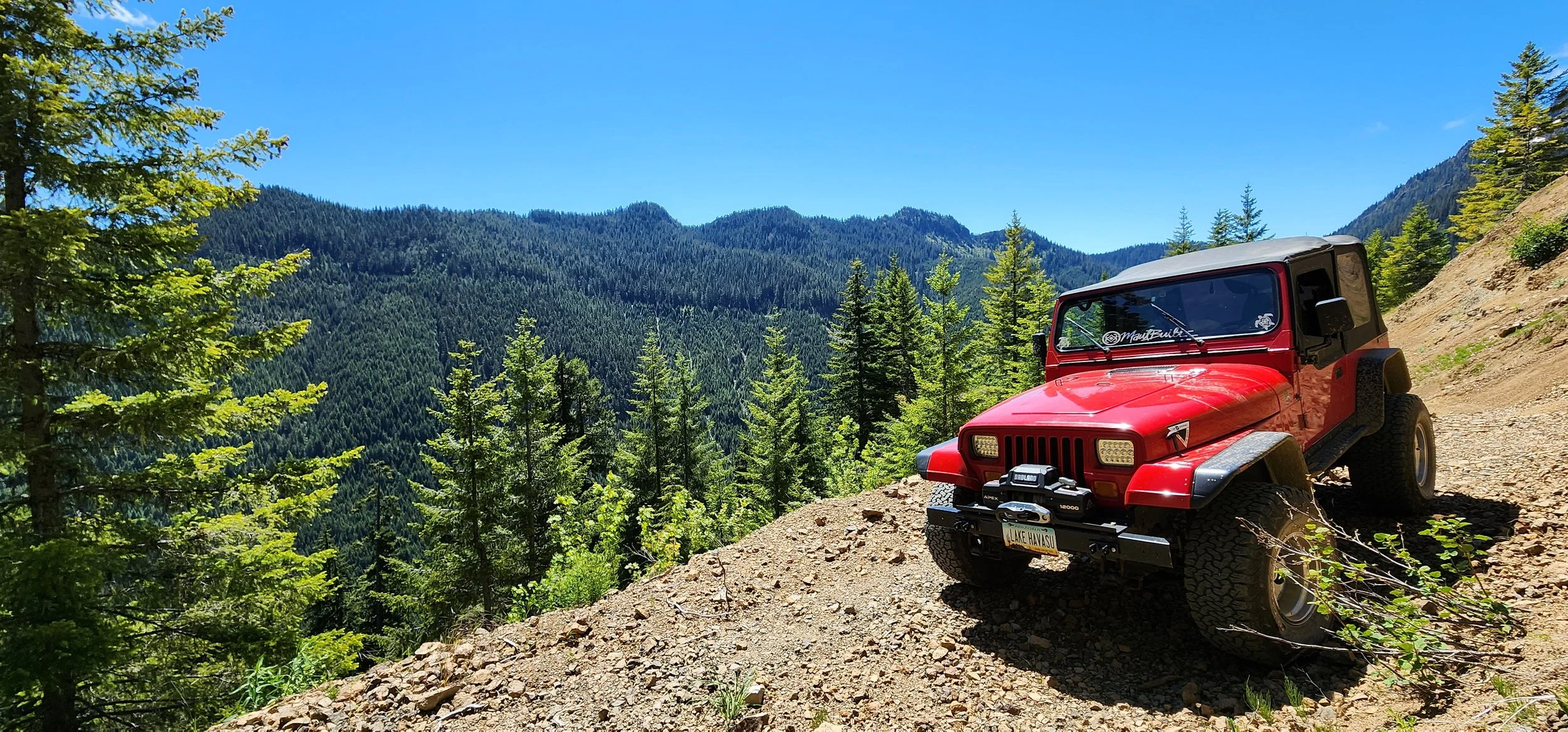
Overlook
Continuing along the trail, you’ll encounter some washouts and technical sections, especially if you’re in a stock vehicle or AWD SUV. Brush along the trail can also scratch your paint, so be mindful. At the end of the trail, there’s another potential dispersed campsite, but honestly, the valley view makes it hard to leave. When I visited, there were still patches of snow, which made for some fun Jeep play.
Trail 2 – Mt. Elinore / Elk Lake / Jefferson Lake Area:
Another adventure took me past Lake Cushman again. This time, rather than turning left toward Staircase at the T intersection, I turned right at Big Creek toward Mt. Elinore, Elk Lake, and Jefferson Lake. The beginning of the trail was fun but crowded, even on a Wednesday, so I decided to venture further north along NF24 to NF2441.
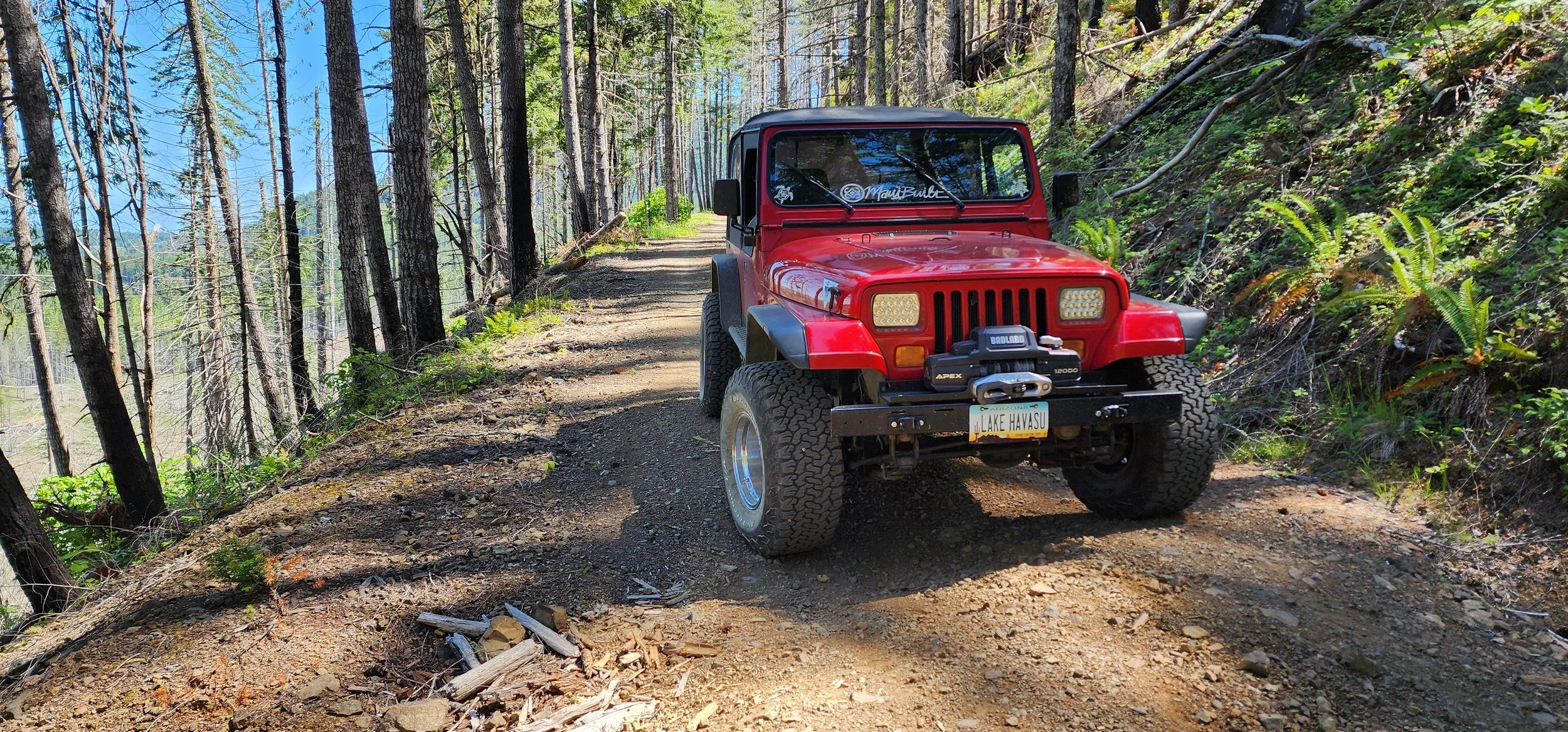
Jefferson Creek Trail
Following this trail, I reached the Elk Lake area, then turned left onto the Jefferson Lake Trail. This trail leads to Jefferson Lake and eventually becomes the Jefferson Creek Trail. Shortly after turning onto Jefferson Creek Trail (as marked on the OnX map), I discovered a beautiful camp spot on the left. The creek runs along the backside of the site. While it’s not ideal for ground tents, it’s perfect for rooftop tents, sleeping in the truck bed, or setting up a hammock.
If you continue up Jefferson Creek Trail for a few miles, there’s another offshoot trail leading to Goober Pond—a hidden gem that I could see spending much more time at.
UPDATE DEC. 2025 - This area does NOT look like this anymore due to a HUGE fire we had on July 4th til mid Oct. Over 19,000 acres burned! Thank you to all the firefighters who helped keep this thing under some control!