
Olympic National Forest

Pulling into my camp spot
Lake Cushman Recon — Spring Mapping Runs
Spring gave me a window to slow down and actually explore the Lake Cushman area instead of just passing through it. As a trail guide for OnX Off-Road, that usually means methodical driving, stopping often, and paying attention to access, terrain changes, and usable camp space—not just pretty views. Cushman delivered.
I mapped two primary routes during this run. Different terrain, different use cases, both worth knowing.
Trail 1 — Staircase Area
Access starts by heading toward Lake Cushman and following signage for Staircase. The road runs along the lake for several miles—easy driving, but don’t get complacent. About half a mile before the Staircase trailhead, there’s a left turn that crosses the lake via a bridge. Take it.
You’ll pass a handful of cabins before hitting a hiking trailhead. Past that point, the road narrows and begins to climb. This is where it starts to matter what you’re driving.
A few miles in, the road splits. Both forks are clearly marked on OnX.
Left fork: Continues climbing and opens into a few dispersed camp spots. Good access, plenty of room for multiple vehicles. Functional, not memorable.
Right fork: Tighter, more enclosed, and more interesting. About halfway in, there’s a short side trail—roughly a quarter mile—that opens into a valley overlook.
That overlook is the kind of place you stop whether you planned to or not. I slung a hammock between the Jeep and a tree and stayed longer than expected. No reason to rush when the terrain tells you to pause.
Past that point, the trail gets more technical. Washouts, uneven climbs, and brush tight enough to earn pinstripes. Stock vehicles and AWD crossovers will need to pick lines carefully. At the end, there’s another possible camp area, but honestly, the overlook earlier on is the real prize.
There was still snow when I ran this trail, which made for good traction lessons and a reminder that elevation changes fast in this area.
Trail 2 — Mt. Elinore / Elk Lake / Jefferson Lake
This route starts the same way—Lake Cushman—but instead of turning toward Staircase, take the right at Big Creek toward Mt. Elinore, Elk Lake, and Jefferson Lake.
The first section is fun but busy. Even midweek, there was more traffic than I wanted to deal with, so I pushed farther north via NF24 and then onto NF2441.
That move paid off.
From there, I reached Elk Lake and turned left onto the Jefferson Lake Trail, which eventually transitions into the Jefferson Creek Trail. Shortly after that transition—clearly marked on OnX—there’s a camp spot on the left worth noting.
The creek runs along the backside of the site. It’s not ideal for ground tents, but it’s solid for rooftop tents, truck-bed sleeping, or hammocks. Functional, quiet, and well-positioned.
Continuing farther up Jefferson Creek Trail leads to another offshoot that takes you to Goober Pond. Low-key, tucked away, and the kind of place you don’t rush through. I could easily spend more time mapping and camping there.
Status Update — Read This Before You Go
UPDATE (Dec 2025):
This area does not look like this anymore.
A major wildfire burned from July 4th through mid-October, consuming over 19,000 acres. Terrain, tree cover, and access have all changed significantly.
If you’re heading out here now:
Expect altered routes
Expect closures or restrictions
Expect unstable ground and debris
Huge respect to the firefighters who kept this from becoming far worse.
This write-up stands as a snapshot in time, not a guarantee of current conditions. Always check current maps, closures, and conditions before rolling in.
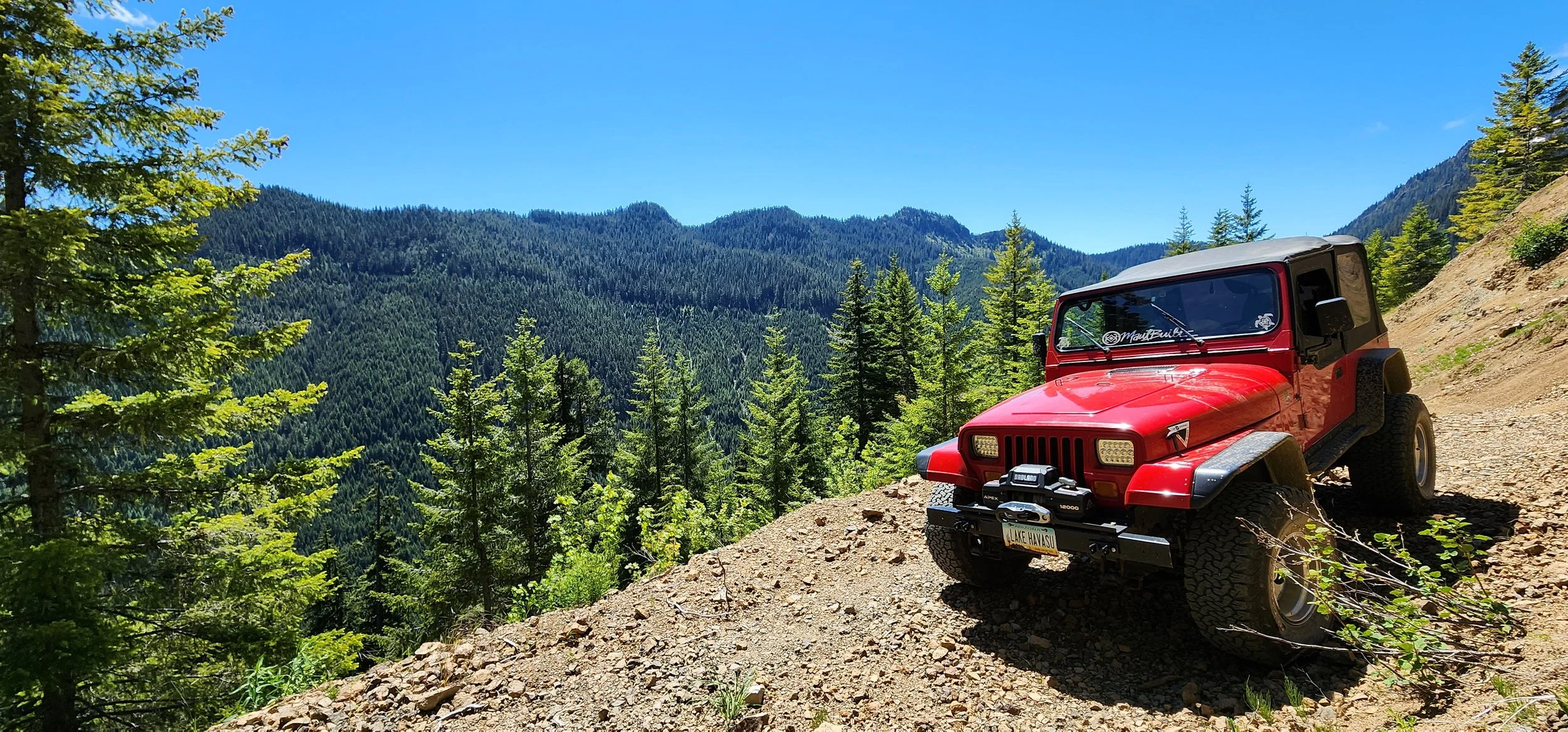
Overlook
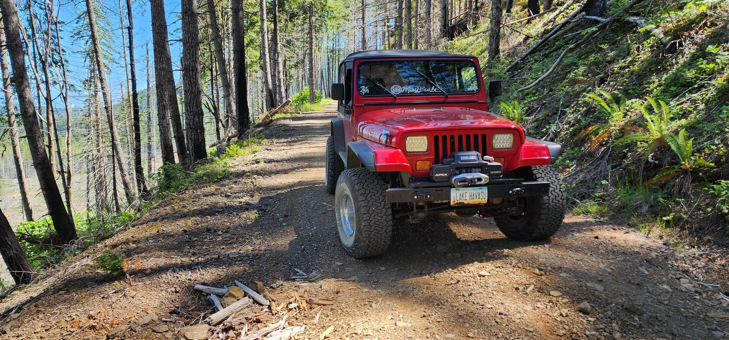
Jefferson Creek Trail